
Answer in brief
The September outlook raises the risk of disruptive weather into 2027, but it does not promise the same outcome everywhere. Here is the verified forecast, its dates and its limits.
the El Niño outlook: what the primary source confirms
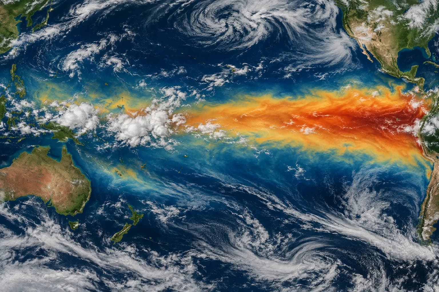
On 3 September, the World Meteorological Organization said El Niño was firmly established and expected to intensify. Its official release is the primary record: [WMO update](https://wmo.int/news/media-centre/el-nino-set-become-very-strong-raising-risks-of-extreme-weather-2027).
El Niño is a coupled ocean–atmosphere pattern, so the official status is more specific than a report of warm water somewhere in the Pacific. WMO’s wording means the large-scale indicators it uses are aligned strongly enough to call the event established. That supports a global seasonal outlook, but it still leaves national services to interpret rainfall, temperature and hazard probabilities for their own territories. The distinction matters because the same phase can be associated with contrasting effects in different regions, and because seasonal risk never replaces an immediate warning issued for a particular place.
the El Niño outlook: the dates that define the update
WMO reported a near 100% likelihood that El Niño conditions would persist through February 2027. That probability applies to the climate pattern across the stated forecast window; it is not a percentage forecast for any one city, storm or loss.
The near-100% figure answers a narrow forecast question: whether El Niño conditions persist through February 2027. It does not say there is a near-certain chance of a specific emergency during every month in every country. A planner should pair the probability with its start and end dates, then ask when WMO will issue the next update and which local product covers the relevant season. Keeping that forecast window intact prevents a high-confidence climate-phase outlook from being transformed into an equally confident claim about a flood, drought or heat episode that WMO did not make.
the El Niño outlook: how to read the headline number
The organisation said the event was expected to become very strong. Reuters also reported the warning, but a high forecast category should not be rewritten as a confirmed record before observations establish one.
Very strong is a forecast intensity category, not a retrospective ranking. Calling the episode the strongest ever would require comparable observations across the relevant index and period, plus an official conclusion after the measurements exist. Reuters coverage helps show why the warning attracted international attention, while the WMO documents retain the exact category and conditions. Readers can therefore take the risk seriously without attaching an unsupported record label. That is more than a semantic choice: emergency planning can use high-end scenarios even while the historical ranking remains unresolved.
the El Niño outlook: who may need to respond
A strong El Niño can shift the odds of heat, rain, drought and other extremes across regions. National meteorological agencies translate the global signal into local forecasts because geography and season determine the actual exposure.
El Niño influences distant weather through teleconnections, but those pathways depend on season and region. A global outlook can raise the odds of certain patterns while a national seasonal forecast narrows the range, and a short-range forecast later identifies actual weather systems. Those products operate at different scales rather than competing with one another. For a Bali business, an Australian farm or a South American water authority, the actionable document will not be identical. The robust workflow starts with WMO, then follows the responsible national agency and finally uses local warnings for time-sensitive choices.
the El Niño outlook: what the evidence does not prove
The bulletin does not guarantee a particular flood, drought, cyclone season or economic impact in a named location. It raises risk and supports preparation; it does not remove the need for shorter-range regional evidence.
Risk language should preserve conditionality. The bulletin justifies asking whether reservoirs, heat plans, crop calendars, insurance assumptions or supply chains can tolerate an adverse season. It does not justify announcing that any named asset will fail. Scenario planning can cover several outcomes, including a less severe local effect, because global strength and local impact are not a one-to-one relationship. Recording trigger levels—such as an official seasonal shift or a local warning—lets teams act on new evidence instead of escalating solely because another dramatic headline repeats the same global forecast.
the El Niño outlook: a proportionate planning response
Water managers, agriculture teams, health services, energy planners and households can review thresholds and contingencies now. The sensible response is to connect the global outlook to official local warnings instead of treating a global map as a local order.
Different sectors can prepare on different lead times. Public-health teams can review heat communication, utilities can revisit demand and water scenarios, agriculture teams can check crop and irrigation contingencies, and households can identify the local alert channels they actually need. None of those steps assumes a disaster is certain; each reduces friction if a relevant regional risk strengthens. The crucial handoff is from the global climate signal to a named local decision owner. Without that handoff, the forecast becomes either frightening background noise or false reassurance rather than useful early information.
the El Niño outlook: questions to ask before repeating the claim
Before sharing a superlative, distinguish observed sea and atmosphere conditions from the forecast intensity ahead. WMO’s [August update](https://wmo.int/resources/publication-series/el-ninola-nina-updates/august-2026) supplies the technical forecast context behind the release.
The WMO release is the authority for the status, probability and projected intensity; the technical update provides forecast detail; Reuters supplies independent news context. These sources should not be blended into an invented consensus stronger than their language. A responsible citation keeps the date and the particular claim together. If a later WMO bulletin revises the probability or observed category, the later document should supersede the earlier forecast for current planning while the older release remains part of the public timeline. That source discipline makes revisions understandable rather than appearing contradictory.
the El Niño outlook: the next signal worth watching
The next useful signals are updated WMO probabilities, observed strength and national seasonal outlooks. A material change in those dated products would justify revising plans and this article; repeated headlines alone would not.
Monitoring can be limited to a small set of signals: WMO’s next ENSO update, observed intensity measures, national seasonal forecasts and short-range official warnings. Social posts that merely restate the 3 September release add no new evidence. A team can schedule a review around the next formal forecast rather than checking every headline, then bring the review forward if its national agency changes a relevant outlook. This cadence preserves attention for the moments when probabilities, observed conditions or local exposure genuinely change and makes any later editorial update traceable to a dated source.
the El Niño outlook: a decision-ready reading of the update
A decision-ready climate note can use three rows. The first records the WMO status, the near-100% persistence probability through February 2027 and the expectation of a very strong event. The second records the latest national seasonal outlook for the location in question. The third records the local short-range warning or operational threshold. These rows should never be collapsed: each has a different horizon, authority and level of specificity. Together they let an organisation prepare early while preserving the right to change course when regional evidence becomes clearer.
For this edition, the durable conclusion is therefore about increased global climate risk, not a guaranteed local disaster or an established historical record. The article should change if WMO revises persistence or intensity, if observations establish a different category, or if a relevant national service changes its seasonal assessment. A traveller, household or business should still follow the official agency responsible for the actual location and date of a decision. That final local check is not a disclaimer added after the forecast; it is the step that turns a global signal into usable risk management.
The strongest practical use of the outlook is a pre-agreed trigger map: WMO defines the global phase, the national service identifies a seasonal shift, and the local authority issues the warning that changes operations. Recording those handoffs now helps teams avoid two costly errors later—acting on a global probability as though it were a local alert, or waiting for certainty until useful preparation time has disappeared.
Practical checklist
- A strong El Niño can shift the odds of heat, rain, drought and other extremes across regions. National meteorological agencies translate the global signal into local forecasts because geography and season determine the actual exposure.
- The bulletin does not guarantee a particular flood, drought, cyclone season or economic impact in a named location. It raises risk and supports preparation; it does not remove the need for shorter-range regional evidence.
- Water managers, agriculture teams, health services, energy planners and households can review thresholds and contingencies now. The sensible response is to connect the global outlook to official local warnings instead of treating a global map as a local order.
- Before sharing a superlative, distinguish observed sea and atmosphere conditions from the forecast intensity ahead. WMO’s [August update](https://wmo.int/resources/publication-series/el-ninola-nina-updates/august-2026) supplies the technical forecast context behind the release.
- The next useful signals are updated WMO probabilities, observed strength and national seasonal outlooks. A material change in those dated products would justify revising plans and this article; repeated headlines alone would not.
Questions and answers
What is confirmed: the El Niño outlook?
On 3 September, the World Meteorological Organization said El Niño was firmly established and expected to intensify. Its official release is the primary record: [WMO update](https://wmo.int/news/media-centre/el-nino-set-become-very-strong-raising-risks-of-extreme-weather-2027). El Niño is a coupled ocean–atmosphere pattern, so the official status is more specific than a report of warm water somewhere in the Pacific. WMO’s wording means the large-scale indicators it uses are aligned strongly enough to call the event established. That supports a global seasonal outlook, but it still leaves national services to interpret rainfall, temperature and hazard probabilities for their own territories. The distinction matters because the same phase can be associated with contrasting effects in different regions, and because seasonal risk never replaces an immediate warning issued for a particular place.
Which date matters: the El Niño outlook?
WMO reported a near 100% likelihood that El Niño conditions would persist through February 2027. That probability applies to the climate pattern across the stated forecast window; it is not a percentage forecast for any one city, storm or loss. The near-100% figure answers a narrow forecast question: whether El Niño conditions persist through February 2027. It does not say there is a near-certain chance of a specific emergency during every month in every country. A planner should pair the probability with its start and end dates, then ask when WMO will issue the next update and which local product covers the relevant season. Keeping that forecast window intact prevents a high-confidence climate-phase outlook from being transformed into an equally confident claim about a flood, drought or heat episode that WMO did not make.
How should the number be read: the El Niño outlook?
The organisation said the event was expected to become very strong. Reuters also reported the warning, but a high forecast category should not be rewritten as a confirmed record before observations establish one. Very strong is a forecast intensity category, not a retrospective ranking. Calling the episode the strongest ever would require comparable observations across the relevant index and period, plus an official conclusion after the measurements exist. Reuters coverage helps show why the warning attracted international attention, while the WMO documents retain the exact category and conditions. Readers can therefore take the risk seriously without attaching an unsupported record label. That is more than a semantic choice: emergency planning can use high-end scenarios even while the historical ranking remains unresolved.
Who should respond: the El Niño outlook?
A strong El Niño can shift the odds of heat, rain, drought and other extremes across regions. National meteorological agencies translate the global signal into local forecasts because geography and season determine the actual exposure. El Niño influences distant weather through teleconnections, but those pathways depend on season and region. A global outlook can raise the odds of certain patterns while a national seasonal forecast narrows the range, and a short-range forecast later identifies actual weather systems. Those products operate at different scales rather than competing with one another. For a Bali business, an Australian farm or a South American water authority, the actionable document will not be identical. The robust workflow starts with WMO, then follows the responsible national agency and finally uses local warnings for time-sensitive choices.
What should be checked next: the El Niño outlook?
The bulletin does not guarantee a particular flood, drought, cyclone season or economic impact in a named location. It raises risk and supports preparation; it does not remove the need for shorter-range regional evidence. Risk language should preserve conditionality. The bulletin justifies asking whether reservoirs, heat plans, crop calendars, insurance assumptions or supply chains can tolerate an adverse season. It does not justify announcing that any named asset will fail. Scenario planning can cover several outcomes, including a less severe local effect, because global strength and local impact are not a one-to-one relationship. Recording trigger levels—such as an official seasonal shift or a local warning—lets teams act on new evidence instead of escalating solely because another dramatic headline repeats the same global forecast.